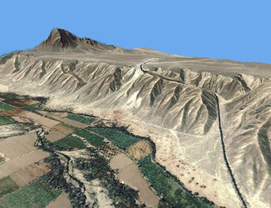
Digital Terrain Model (DTM)
The very first regional digital terrain model (DTM) of the whole area (approx. 500 km2)
had been worked out by digitizing contour lines and single points by using existing
topographical maps. The DTM was generated with the software SCOP.
In the meantime there is a global DTM with a resolution of 90 m as a result of the Shuttle Radar Topography Mission (SRTM) available for free.
A local Digital Terrain Model was generated from photogrammetric aerial imagery with high accuracy.
Another regional DTM was generated by using ASTER satellite stereo data (resolution: 15 m).
Within the TanDEM-X Mission, an even more precise global DTM will become available.
|